Geographic Information Systems
Most popular
 Status: Free Trial
University of California, Davis
 Status: Free Trial
University of California, Davis
 Status: Free Trial
University of Toronto
 Status: Free Trial
Johns Hopkins University
Trending now
- Status: Free Trial
University of California, Davis
- Status: Free Trial
Johns Hopkins University
- Status: Free Trial
University of Toronto
- Status: Free Trial
University of California, Davis
New releases
 Status: Free Trial
Case Western Reserve University
 Status: Free Trial
Skillshare
 Status: Free Trial
 Status: Free Trial
Case Western Reserve University
Filter by
SubjectRequired
LanguageRequired
The language used throughout the course, in both instruction and assessments.
Learning ProductRequired
LevelRequired
DurationRequired
SubtitlesRequired
EducatorRequired
Results for "geographic information systems"
 Status: Free Trial
University of California, Davis
Skills you'll gain: ArcGIS, Spatial Analysis, Data Storytelling, Spatial Data Analysis, Geographic Information Systems, Data Presentation, Geospatial Mapping, Public Health and Disease Prevention, Data Sharing, Public Health, Land Management, Geospatial Information and Technology, Heat Maps, Epidemiology, Community Health, Data Visualization Software, Data Quality, Network Analysis, Data Mapping, Data Modeling
 Status: Free Trial
University of Michigan
Skills you'll gain: Sustainable Development, Geographic Information Systems, Geospatial Mapping, Sustainability Reporting, Spatial Data Analysis, Sustainable Business, Spatial Analysis, Data Storytelling, Environmental Monitoring, Data Visualization, Stakeholder Engagement, Trend Analysis, Decision Making
 Status: Free Trial
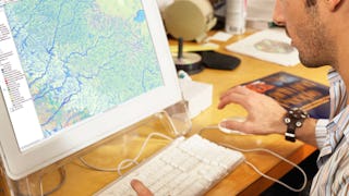
University of California, Davis
Skills you'll gain: ArcGIS, Geographic Information Systems, Data Sharing, Geospatial Mapping, Spatial Analysis, Metadata Management, Data Mapping, Data Visualization, Data Analysis, Software Installation, Data Quality, Data Integration
- Status: Free Trial
University of Toronto
Skills you'll gain: ArcGIS, Spatial Data Analysis, Spatial Analysis, Geographic Information Systems, Geospatial Mapping, GIS Software, Data Mapping, Geospatial Information and Technology, Data Visualization, Metadata Management, Query Languages, Global Positioning Systems, Quantitative Research, Data Compilation, Typography, Data Manipulation, Data Storytelling, Data Modeling, Design Elements And Principles, Image Analysis
 Status: Preview
École Polytechnique Fédérale de Lausanne
Skills you'll gain: Geographic Information Systems, Data Modeling, GIS Software, SQL, Database Design, Spatial Data Analysis, Database Management, Query Languages, Relational Databases, Data Capture, Data Storage
 Status: Free
Coursera Project Network
Skills you'll gain: ArcGIS, Data Presentation, Spatial Data Analysis, Data Visualization, Geographic Information Systems, Geospatial Information and Technology, Geospatial Mapping, Data Import/Export, Data Mapping, Data Manipulation, Data Management
What brings you to Coursera today?
 Status: Free Trial
L&T EduTech
Skills you'll gain: Geospatial Information and Technology, Spatial Analysis, GIS Software, Spatial Data Analysis, Geographic Information Systems, Geospatial Mapping, Construction Engineering, Database Management, Construction, Construction Management, ArcGIS, Global Positioning Systems, Visualization (Computer Graphics), Decision Support Systems, Building Information Modeling, As-Built Drawings, Survey Creation, AutoCAD Civil 3D, Data Manipulation, Network Analysis
 Status: NewStatus: Free Trial
Skillshare
Skills you'll gain: Photography, Photo Editing, Photo/Video Production and Technology, Storytelling, Geospatial Information and Technology, Geospatial Mapping, Geographic Information Systems, Global Positioning Systems, Creativity, Image Quality, Planning, Research, Creative Thinking, Adobe Creative Cloud, Design Elements And Principles, Aesthetics, Critical Thinking, Data Import/Export
 Status: Free Trial
University of Michigan
Skills you'll gain: Environmental Monitoring, Global Positioning Systems, Environmental Science, Physics, Mechanical Engineering, Environment, Physical Science, Climate Change Programs, Engineering Calculations, Geographic Information Systems, Scientific Methods, Manufacturing and Production, World History, Chemical Engineering, International Relations, Engineering Analysis, Electrical Power, Political Sciences, Emerging Technologies, Timelines
 Status: NewStatus: Free Trial
Case Western Reserve University
Skills you'll gain: Exploratory Data Analysis, Spatial Data Analysis, Spatial Analysis, Geospatial Information and Technology, Descriptive Statistics, Statistical Modeling, R Programming, Geographic Information Systems, Statistical Analysis, R (Software), Probability & Statistics, Ggplot2, Oil and Gas, Data Analysis, Simulations, Statistical Methods, Rmarkdown, Data Cleansing, Box Plots, Plot (Graphics)
 Status: NewStatus: Free Trial
Skills you'll gain: Photography, Geospatial Information and Technology, Geospatial Mapping, Geographic Information Systems, Global Positioning Systems, Planning, Research, Creative Thinking, Critical Thinking, Data Import/Export
 Status: Free Trial
University of Colorado Boulder
Skills you'll gain: Global Positioning Systems, Journalism, Environmental Monitoring, Music, Geospatial Information and Technology, Political Sciences, Entrepreneurship, Systems Engineering, Concept Of Operations, Culture, Media and Communications, Governance, Higher Education, Public Policies, Physical Science, Liberal Arts, Geographic Information Systems, Art History, Engineering Design Process, Writing


